Vrises - Chora Sfakion,
West Crete
The 38-kilometer journey from Vrises to Chora Sfakion is arguably the most iconic road on the island. It is a dramatic transition from the lush, green foothills of the north to the stark, vertical limestone deserts of the south. This route is a favorite for motorists and motorcyclists alike, offering a perfect blend of high-speed sweeping curves and technical mountain hairpins.
1. The Ascent to the Clouds
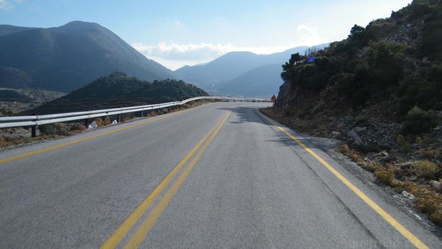
Starting just after the village of Vrises, the road begins its steady climb into the heart of the White Mountains. The initial section is characterized by wide, well-maintained asphalt and sweeping bends that carve through dense greenery. As you gain altitude, the air cools significantly, and the olive groves of the north give way to the rugged Mediterranean cypress and ancient oak trees of the high ridges.
2. The Askyfou Plateau (15 km)
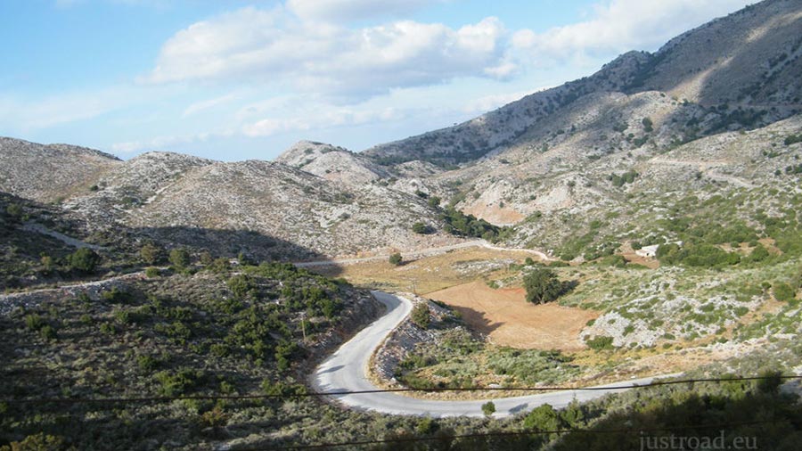
About 15 kilometers into the journey, the mountains suddenly open up to reveal the Askyfou Plateau. This high-altitude basin, surrounded by towering peaks, feels like a world of its own. It is a place of traditional stone houses and war memorials, serving as a peaceful intermission before the road begins its final, dramatic descent toward the Libyan Sea.
3. The Imbros Pass and Tunnels
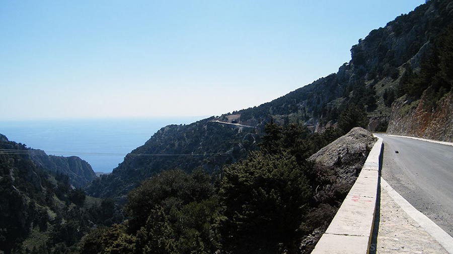
Continuing south, you reach the village of Imbros, famous for being the entrance to the spectacular Imbros Gorge. The road here becomes more intimate, hugging the rim of the canyon. You will pass through a series of small, rock-hewn tunnels where the road runs parallel to the deep chasm of the gorge. This section offers a sense of the raw scale of the Sfakian landscape.
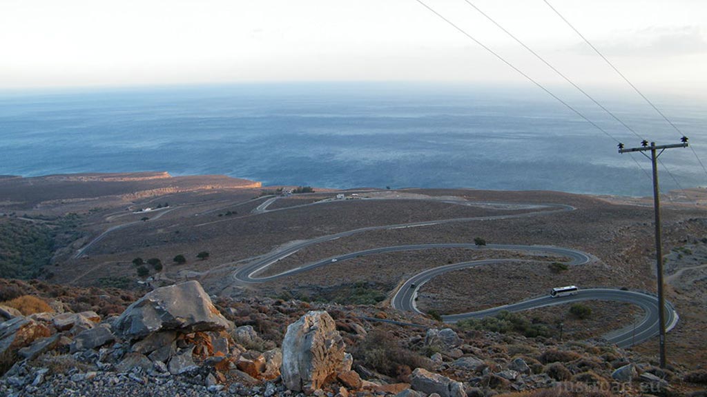
4. The Descent: The "Big View"
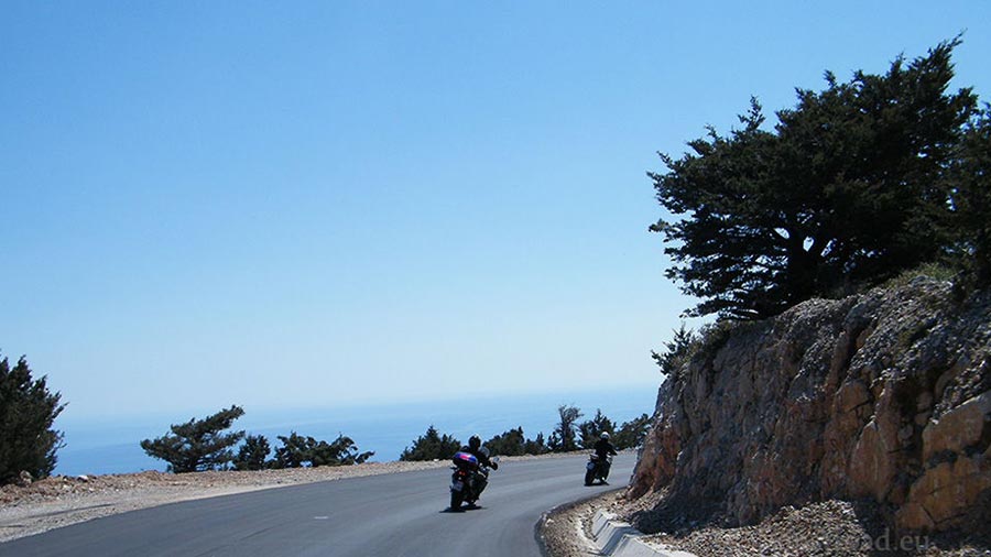
Immediately after the tunnels, the landscape explodes into one of the most breathtaking views in Greece. The road begins a dizzying descent toward the coast via a series of classic mountain hairpin bends. From this vantage point, the Libyan Sea appears as a vast, shimmering blue wall, and on clear days, you can see the outline of Gavdos Island on the horizon. The sheer vertical drop from the mountains to the sea level creates a profound sense of scale.
5. The Coastal Finale
As the hairpins level out, the route turns west, tracing the base of the mountains parallel to the sea. This final stretch is a rhythmic drive through sun-bleached rock and low scrub, leading you directly into the harbor of Chora Sfakion—the historic and defiant capital of the south.
Whispers of the Pass: Local Secrets
The Sfakian Pie: A stop in Askyfou or Imbros is mandatory to try the "Sfakiani Pita"—a thin, cheese-filled pancake served with local thyme honey.
The Castle of Kulé: High above the Askyfou plateau, look for the ruins of a Turkish fortress that once guarded this vital mountain pass.
The Evacuation Path: This road follows the historic route taken by thousands of Allied troops in 1941 as they retreated through the Imbros Gorge to be evacuated from the Sfakia harbor.
Rider’s Notes
Road Width: Wide and high-quality for most of the route. The hairpins above Sfakia are wide enough for comfortable leaning, but stay alert for tour buses in the corners.
Surface: Excellent asphalt throughout, though it can become slippery when wet (especially in the shaded mountain turns).
Difficulty: This is a very "flowy" and enjoyable road. The difficulty comes primarily from managing your speed on the steep descent and staying focused despite the distracting views.
Caution: Watch for goats! They are the "owners" of this road and often congregate in the tunnels or on the warm asphalt of the hairpins.
Info box
Surface: Asphalt
Road classes: B road
Terrains: Mountainous
Traffic: Moderate
Coordinates start (DD): 35.365186,24.199742
Coordinates end (DD): 35.199719,24.139693