Prasies - Mt. Vrisinas peak,
Central Crete
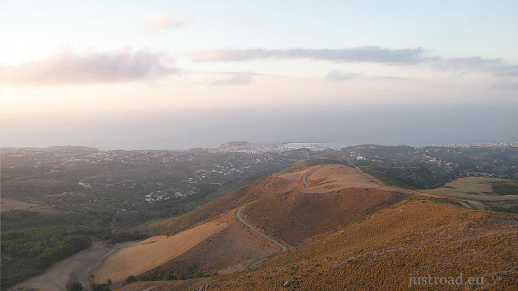
Scaling Mt. Vrisinas from the village of Prasses is a vertical expedition to the highest sentinel overlooking Rethymno. This is a purely unpaved route that transitions from a standard mountain track into a high-stakes technical climb, demanding a capable vehicle.
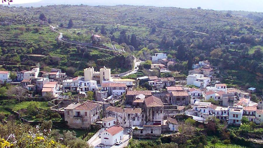
Starting from the traditional village of Prasses, this route is a direct ascent into the rugged heart of the Vrisinas range. It is a journey designed for true off-road enthusiasts, leading to one of the most significant spiritual and geographical landmarks in Central Crete.
1. The Initial Ascent
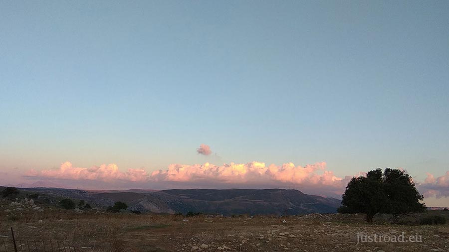
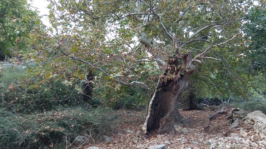
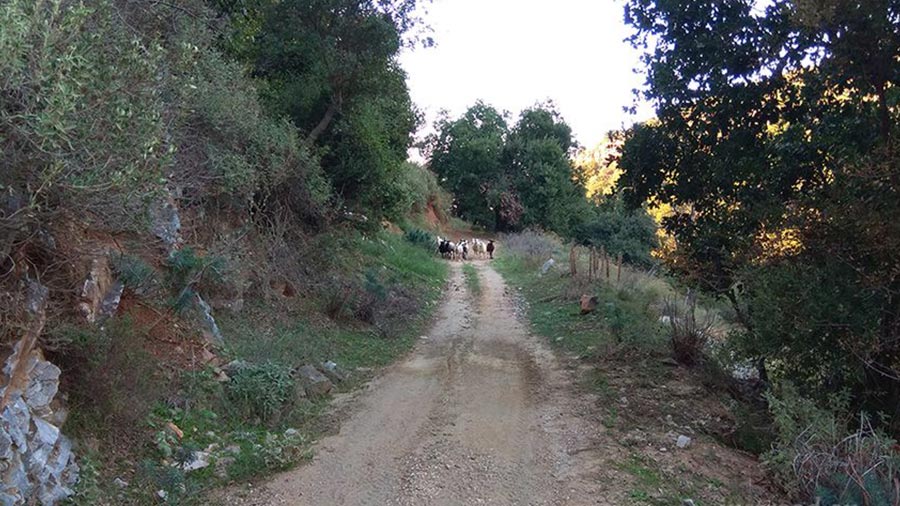
The journey begins on a standard unpaved road exiting Prasses. For the first 1.8 kilometers, the track is relatively straightforward, winding through the rocky foothills. The elevation gain is steady but manageable, offering early views of the northern coastline and the surrounding Cretan landscape.
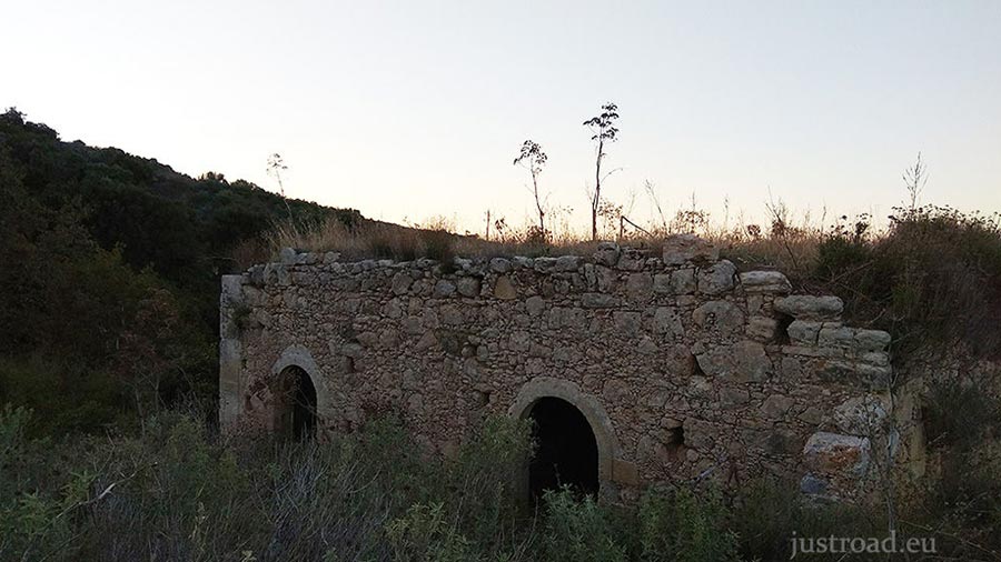
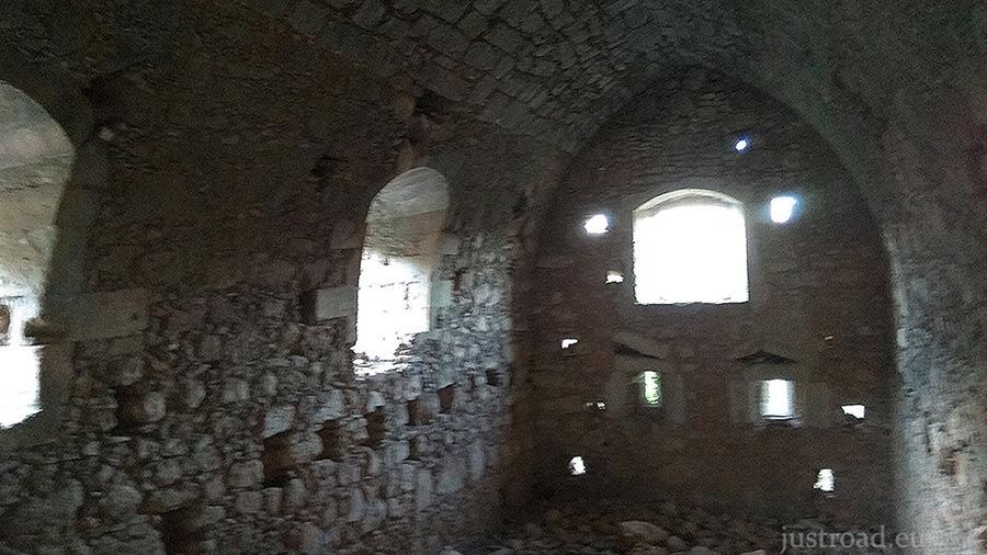
2. The Turkish Ruins (2.0 km)
At the 2.0-kilometer mark, the landscape offers a historic pause. To your right, located just a few meters off the path, you will find the ruins of an old Turkish building. The crumbling walls serve as a silent marker before the route’s primary challenge begins.
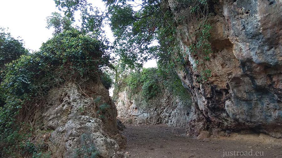
3. The "Filter": The Technical Section
Immediately after the ruins of the building, the nature of the road changes drastically. For the next 800 meters, the route becomes a narrow, rocky "bottleneck" carved into the mountain's edge. This is the most demanding part of the route pushing the difficulty level to a 10. The path is exceptionally narrow and rugged; while it has been navigated by dedicated off-road 4x4s, it is primarily a passage for lightweight Enduro or pure Dirt bikes. Precision is required here as you navigate uneven limestone, tight clearances, and encroaching vegetation.
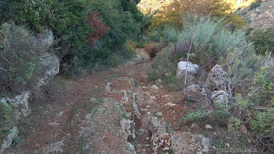
4. The Final Stretch to the Summit
Once you clear the 800-meter technical section, the road returns to a "normal" unpaved surface. The final climb to the peak is a series of wide zig-zags across the mountain's spine. As you reach the summit, the trees vanish, leaving you in a high-altitude world of wind and stone.
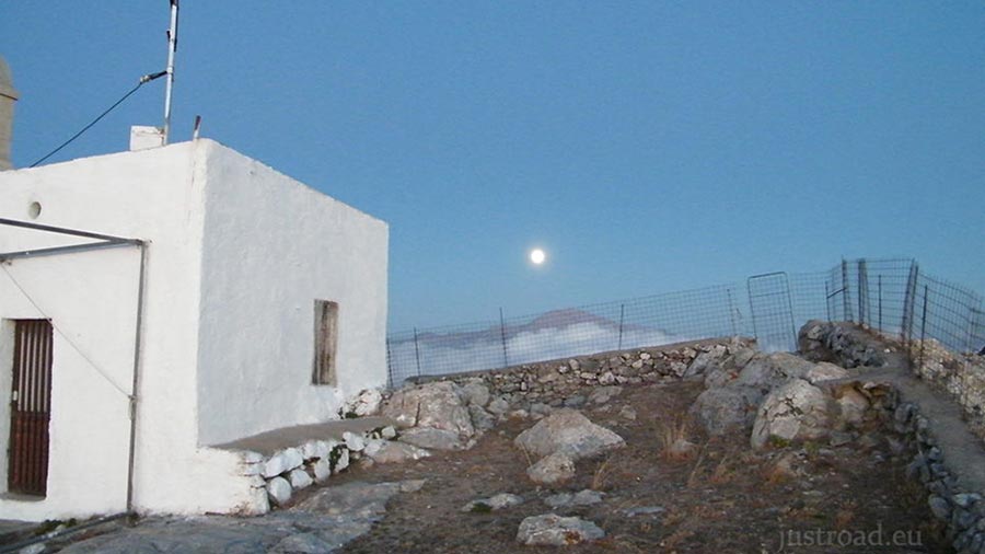
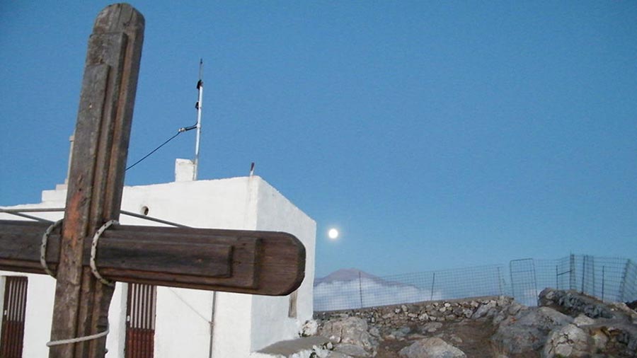
5. The Summit: Chapel of the Holy Ghost
The reward is a staggering 360-degree panorama. On a clear day, you can see the Cretan Sea to the north and the Libyan Sea to the south simultaneously, with the massive snowy peaks of Psiloritis dominating the eastern horizon.
Whispers of the Peak: Local Secrets
Minoan Peak Sanctuary: Long before the chapel, this summit was a sacred Minoan site. Archeologists have found thousands of clay figurines here, left by ancient Cretans who climbed this mountain 3,500 years ago.
The Dual-Sea View: Because of the island's narrow "waist" at this point, Vrisinas is one of the few places where you can witness two different seas from a single standing position.
The Annual Pilgrimage: Every year during the feast of the Holy Spirit (Pentecost), locals make the arduous trip up this road to celebrate at the peak's chapel.
Rider’s Notes
Road Width: Standard unpaved width for most of the route, but extremely narrow and restricted during the 800m stretch following the old building ruins.
Surface: Unpaved throughout. The 800m "Filter" is rocky and technical; the rest is a typical mountain dirt track.
Difficulty: 10. The rating is specific to the technical 800m section after the Turkish ruins building.
Caution: HEAVY OFF-ROAD ONLY. Do not attempt the section after the ruins in a standard vehicle or a heavy street/touring motorcycle. This is strictly Enduro/Dirt bike territory. It is possible in a specialized 4x4 off-road car, but it is extremely difficult to pass the narrow sections with thick vegetation. Riders should be prepared for loose limestone and potential high winds at the summit.
Info box
Surface: Unpaved
Unpaved difficulty level: 10 (hard)

Road classes: Unclassified
Terrains: Mountainous
Traffic: Almost none
Coordinates start (DD): 35.320221,24.531845
Coordinates end (DD): 35.312285,24.495356